The Unlockdowning
As we approached the partial lifting of pandemic lockdown in Ireland in late March 2021, I wanted to celebrate in some way that involved trails, hills and running. Luckily for me, the brilliant Tough Soles published a new summary video on YouTube of their Sheep’s Head Way hiking trip from 2018. I was immediately sold.
The route
The official Way web-site has a ton of useful info including a trace of the whole route. After jumping through some software hoops to convert the KML/KMZ to GPX, I soon had it on Viewranger on my phone and on my Garmin InReach. So at least I wouldn’t get lost or my body would be easier to find. Here’s my GPX copy in case you want to use it.
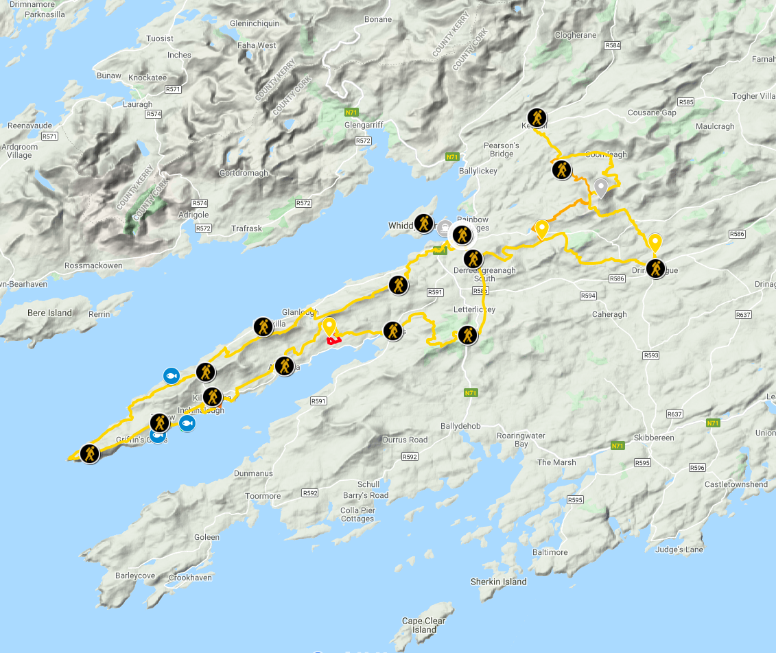
The main loop is 58 miles / 93 km over a variety of surfaces and terrain. It starts in Bantry at the gatehouse of Bantry House, runs mostly off-road along the north side of the peninsula until it reaches the lighthouse and then returns mostly within spitting distance of the main road on the southside, skirting Kilcrohane, Ahakista and Durrus, before ending back where it started.
The pack
My big worry was time. Would I be able to do it all in one day or would I have to overnight it somehow? I decided to play it safe and assume I’d end up outdoors overnight in April for the first time since I was a boy scout in the 1980s. I ordered a light tent, sleeping bag and MSR gas stove online. Only the stove arrived in time, thanks to the lovely people in Wild Side Sports (and less thanks to the slow-coaches in TrekkInn).
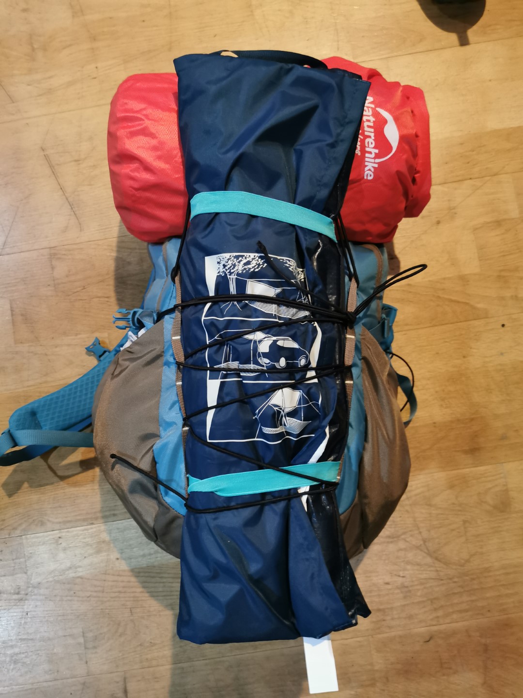
So the weekend before was very stressful. I opted to use a Patagonia 28L commuter rucksack to carry everything and suddenly remembered I’d bought a Decathlon tarp last year in the staycation panic-buying-phase we we all in during May/June 2020. I also had an old Aldi/Lidl ultra light sleeping bag and lots of bivvy bags and space blankets. Sure I’ll be grand I thought.
After packing enough stuff for an assault on K2, including food for three days. I weighed the bag. 13kg. Without water. And I was somehow going to run with this? Some major rejigging later got me to 8kg. But I was so concerned about access to water (despite including both chlorine tablets and a Lifestraw) that I added 3 litres in softflasks. So 11-ish kg. Heavy but possibly manageable. I added some bungees as a waist strap just in case.
The start in Bantry
A 4.30am start in Bandon had me at the camper-van car-park in Bantry ready to go at 6.30am on April 12th. Seeing that the main gate in Bantry House was shut, I immediately had to go off-route and just headed out the N71 to get to the side-road and begin the adventure.
After 50 yards I realised I’d made a dreadful mistake with the pack. It was completely impossible to run with it. It not only weighed a ton, it also bounced all over the place and was unbalanced. So I resigned myself to power-hiking the entire thing. Or walking as normal people call it.
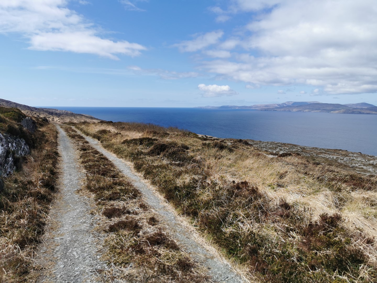
One thing I noticed about the Way is that it will send you off-road whenever it can, right from the start, even when the road is reasonable. Sometimes I really liked that, particularly when there was something interesting to check out. Other times, much later, it was “jesus, lumpy fields, again?”
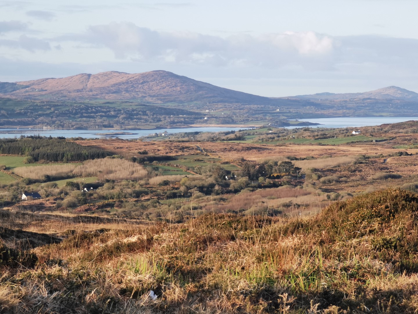
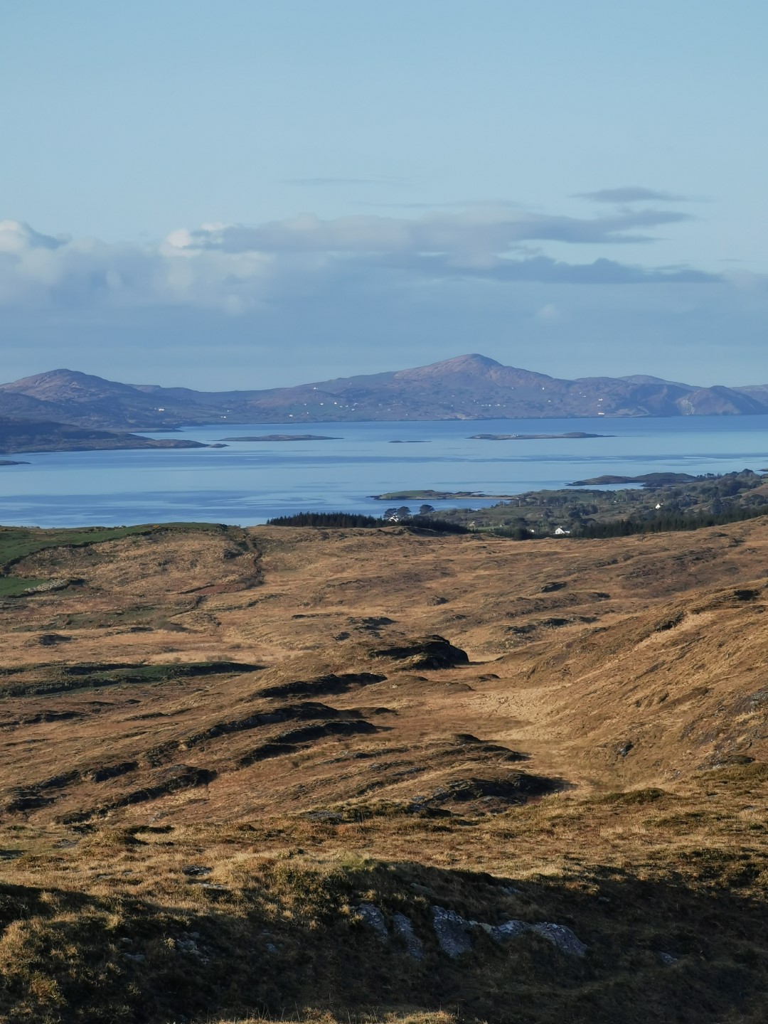
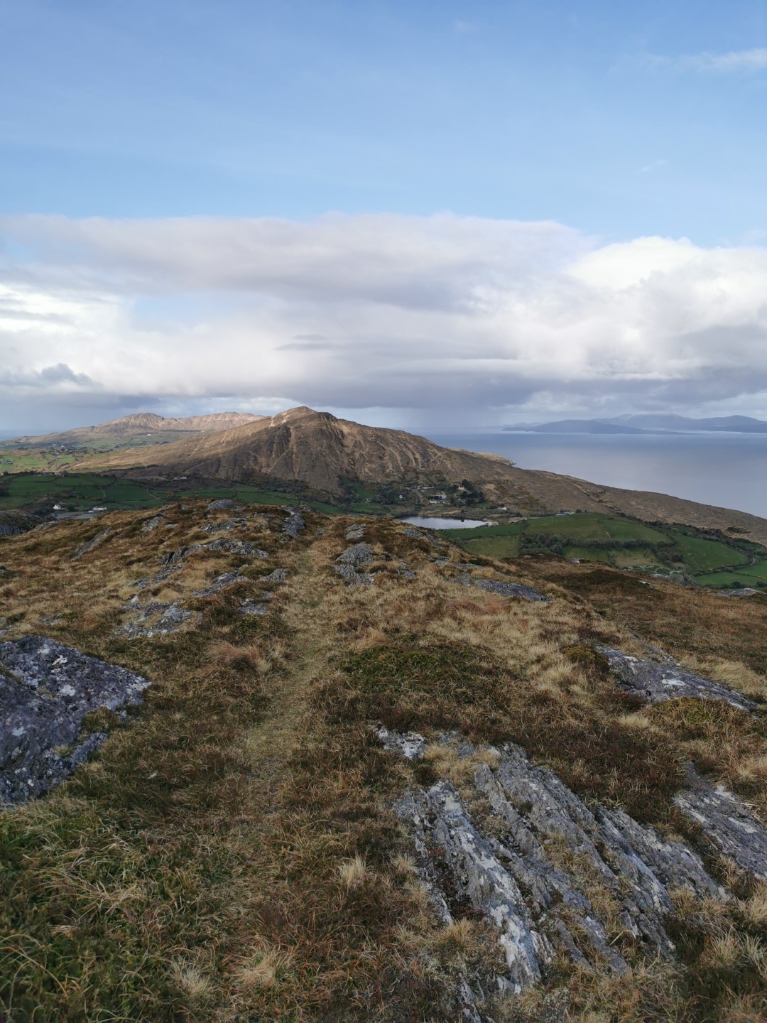
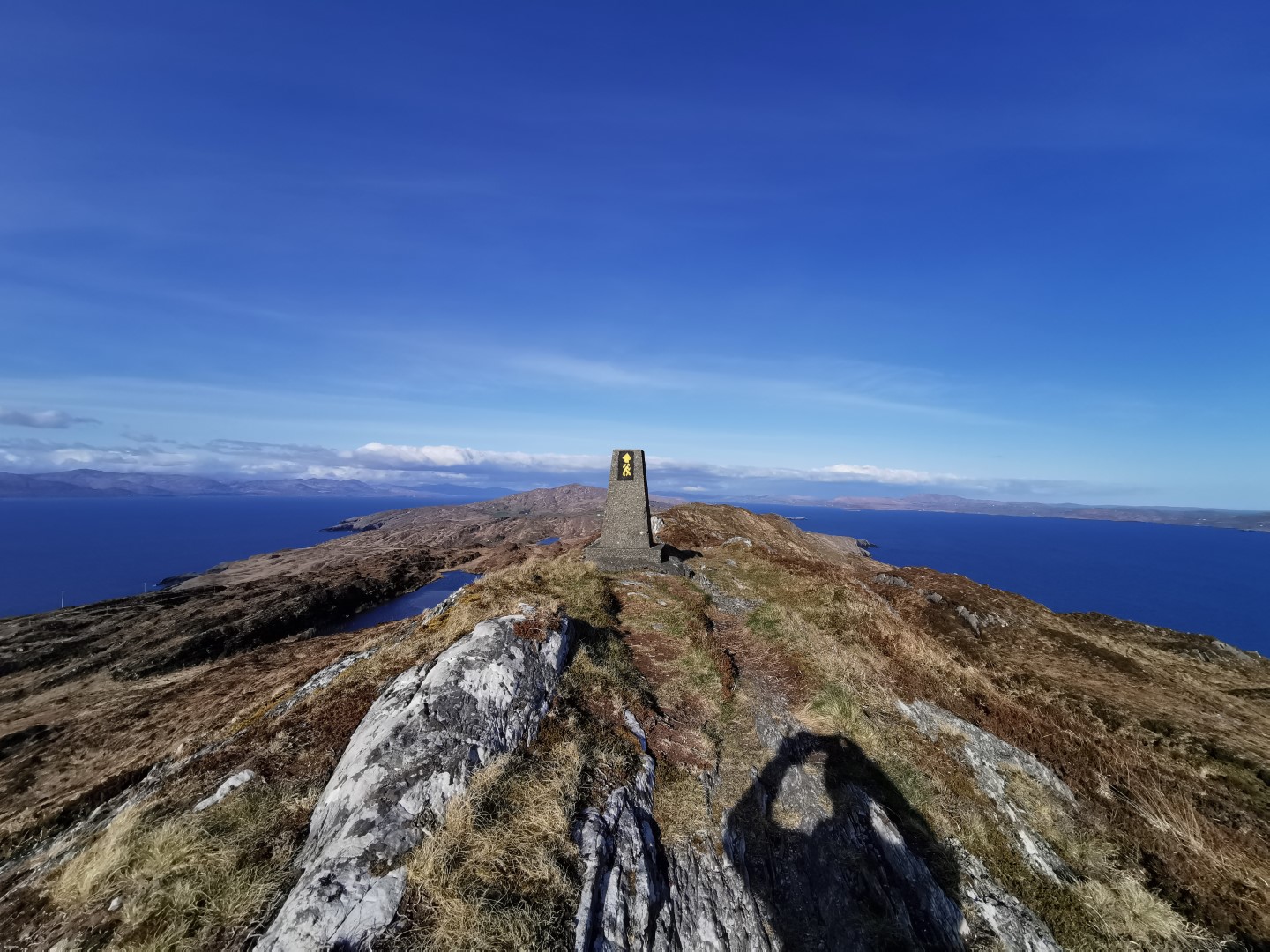
OMG The views
The first four miles are mostly on-road but felt completely safe with maybe two cars. Once you get off-road, you’ll spend the next many hours in awe of the views. Every time you think it can’t get any more beautiful, it does. Now to be fair, I picked an absolutely perfect day. Over the entire route I had 5 minutes of drizzle and maybe an hour where it got a bit too hot. Late at night in the dark was the only cold time. There were parts, as you approach the end of the peninsula, that would be terrifying in windy conditions. But for me, everything was crystal clear and fog-free with a gentle breeze.
I adored every minute of the outbound leg.
Ireland vs The Continent
I met one Eastern European man who had the same idea as me to get as far from his 5km as he possibly could. And a couple of people near the lighthouse later who had presumably driven to the car-park near there. In fact there were more Eastern Europeans than Irish out that day, which is an interesting reflection of our respective relationships with the outdoors I think.
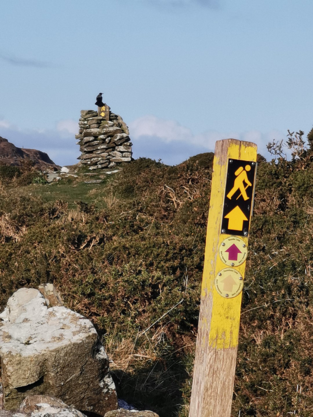
Navigation
As Ellie from Tough Soles pointed out, the way-marking on this trail is incredibly good. You rarely go more than a few hundred metres without seeing the little yellow person on a pole or a rock. In decent visibility, you rarely need to refer to the electronic route and of course as long as you can see the water, you know you are roughly heading in the right direction.
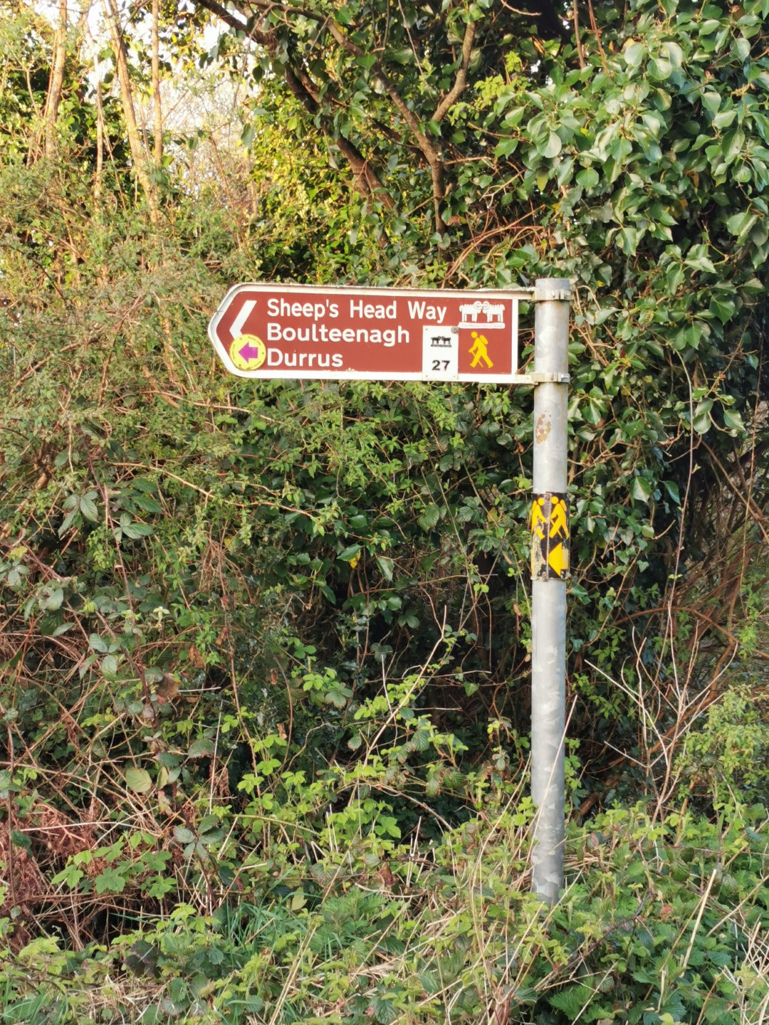
I only spotted one sign pointing completely the wrong way at Glanlough when you reach the road (you turn right, not left). And two that had fallen down. Not bad for 500+ markers! At night they reflect light well, but as I describe later, that wasn’t enough to save me towards the end.
To use American-lingo, I guess my mini-adventure would be considered an unsupported Thru-Hike, albeit a very short one as it’s no PCT or AT. But it’s still possible to get in trouble on any trail and to give my wife a degree of comfort that I’m not unconscious somewhere on the trail, I always use my Garmin InReach Explorer to ping the old Iridium satellite network every 15 minutes with my location. Its hardware design is like an old school Nokia N95 from 2007 but it is bullet-proof. It worked perfectly throughout the route and still had 65% battery when I checked the following day. The expensive monthly fee is worth it for peace of mind during those active months in the year. In contrast, I was very grumpy that my Garmin Forerunner 935 gave up the ghost in the last mile but I didn’t have Ultra Trac mode enabled on it. Separately, I was very surprised to have perfect 4G for almost the entire northside of the route. Presumably that was due to line of sight to towns on the Beara peninsula?
The difficulty level
That first big leg as far as Glanlough is completely family-friendly. The worst thing you can likely do is scratch your knee or get stuck in some boggy ground.
Speaking of which, the vast majority of the route was very light on the usual West Cork trail bog. I know it hasn’t rained much recently but there are plenty of routes in West Cork that are permanently waterlogged. And even more unusually, the route worn into the ground by people and sheep was generally the dryest part. And in many cases, rocks or reeds have been placed down in the bad bits. I managed to get over 30 miles before submerging up to my ankle. And that’s when I went off the route for a wee.
So a huge thank you to everyone involved in maintaining the Sheep’s Head Way, including all the landowners.
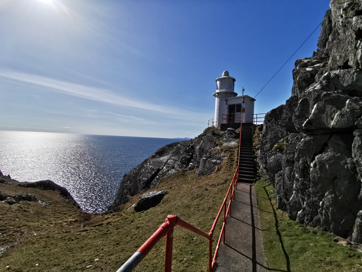
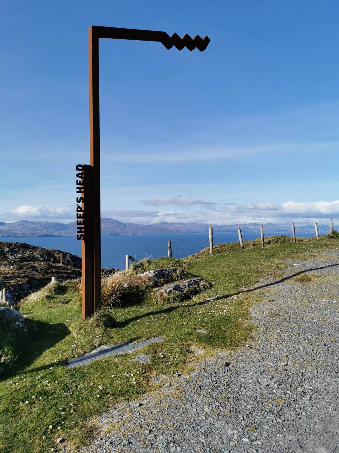
The lighthouse
I slowed down quite a bit in the latter miles approaching the end of the peninsula. The ground became much more uneven and rocky and it was hard to get the nice rhythm I had going along the ridge-lines in the earlier sections.
The views around the lighthouse are completely epic. In fact, I realised that I’d been grinning almost continuously for over 11 hours. I also kept saying “holy fuck” over and over. It really is that beautiful.
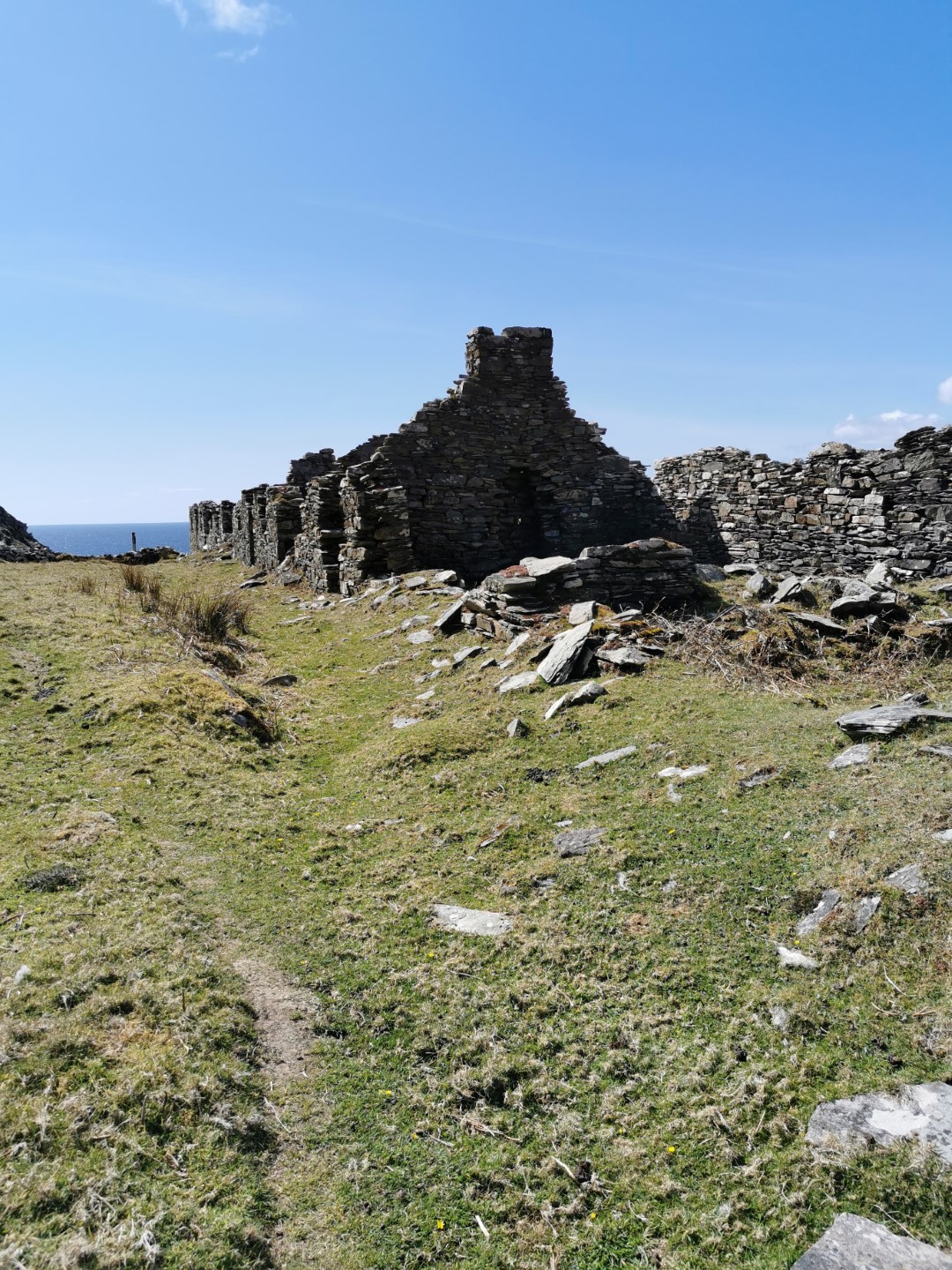
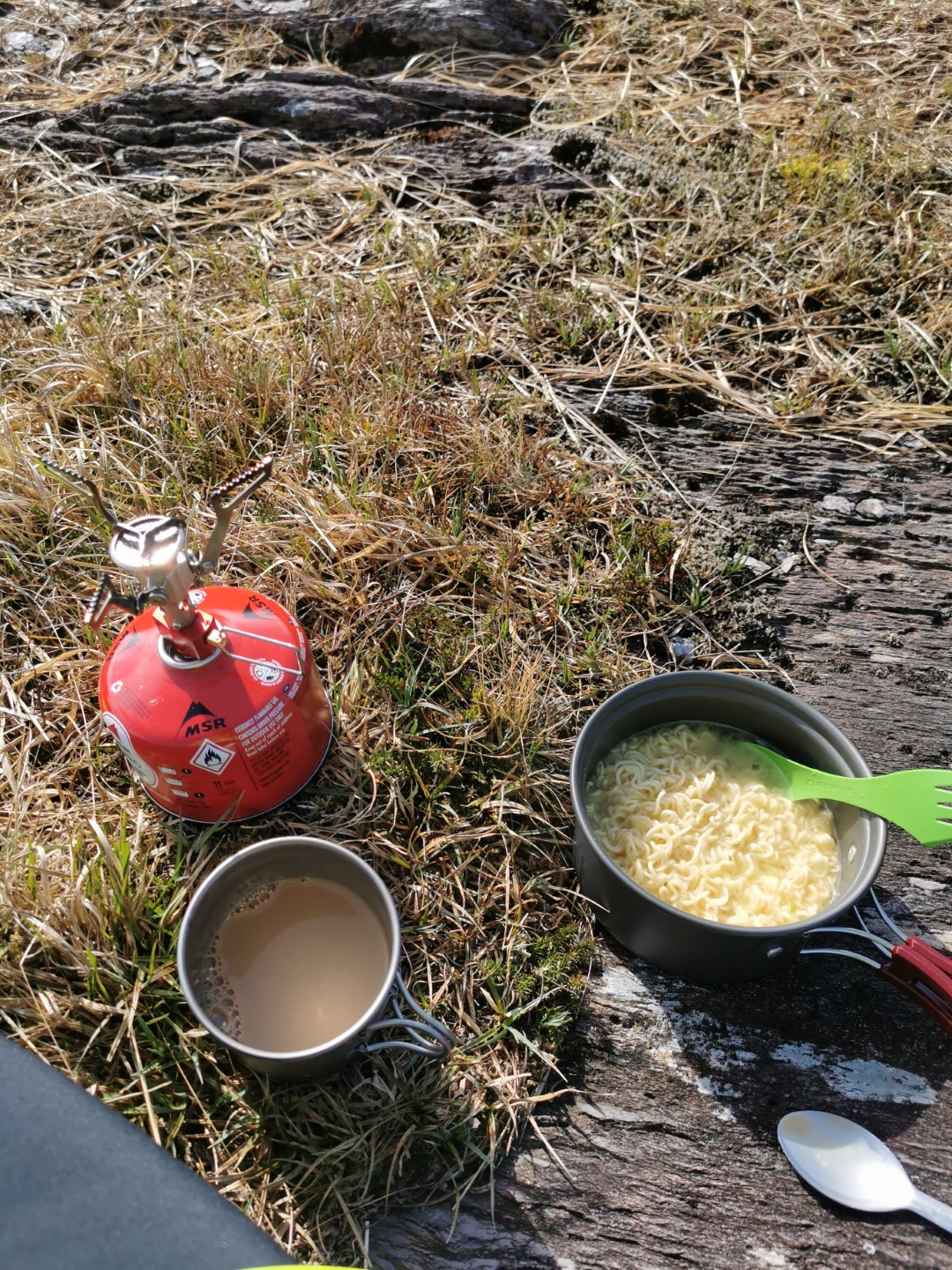
I had my second warm meal and cup of coffee around there on the MSR stove and was glad I’d carried that particular extra weight. Of course, post-pandemic there’s an actual cafe a mile up the road. I’d hoped for a bit of gentle road walking for a while after the recent roughness but it was not to be. I was sent immediately off-road after the cafe to see the old WWII look-out and trig point.
The southside
The main thing about the return leg is that you are rarely more than 20 minutes from a house. So if things do go badly wrong you can get help easily. Mid-pandemic, I’m not sure how many people would welcome you at their door, but in an emergency of course they’d help.
I was very glad I brought all that water as there was almost nothing out there. And again, with the pandemic I did not want to be bothering any old farmers with a request for a top-up. There were some ropy looking bog lakes and one or two streams/run-offs in the first 45 miles that I’m sure would have been safe with the Lifestraw, but I can imagine what the taste was like. Durrus was the first time I saw an actual water outlet. Maybe something to consider for the future, even in exchange for a donation to a maintenance fund?
There was a chunk of miles along old dirt tracks which were nice and easy and mostly downhill. Plenty of houses and farms too, compared to the northside. But as I approached Kilcrohane, more and more of the route was over fields that were completely churned up by cows and very hard to walk on as the ground had dried out.
Cowwwwwwwwwwws
Worse, I had multiple encounters with extremely exuberant herds of cows and young bulls. The first one was actually terrifying. Imagine 20+ large animals suddenly seeing you and all simultaneously barrelling at you at full tilt. I had no bloody idea cows could move that fast. I backed out to the field entrance and they all crowded around me. I could see no route around so, with running poles akimbo to make myself bigger, I started walking through them. Some of them followed me quietly, some lost their minds in fear and raced off to a safe distance. Others kicked their hind legs up like bucking broncos. Finally I got to the other side of the field, climbed the stile and breathed a huge sigh of relief.
Except that happened three more times. I realised afterwards that I was probably the first person any of them had seen, apart from the farmers, in months. They were bored out of their minds. I have to apologise to the farmer who I could hear shouting after his herd, trying to get them from one field to the next, after they’d all legged it after me.
As a mostly edge-of-townie, I still don’t know how much danger I was in. I obviously know enough to watch out for small calves and giant big-bollocks bulls, but I don’t know if there’s a better way to deal with “enthusiasm” that could get you a hoof in the head.
The dark
At this point it was now dark and the temperature plummeted. I got out the head-torches and trudged along. There wasn’t a sinner to be seen in Kilcrohane itself. Once off-road again (more cows), I began to find it harder and harder to navigate. When I could see the waymarker reflections in the distance, it was fine, but when I couldn’t, it was too easy to veer left or right off the “track”. I was constantly having to stop and check Viewranger and started getting cold too.
By the time I got to near Ahakista, I was running out of energy. I was now 16 hours on my feet, beating my previous record of 14 hours for the Liverpool to Manchester 50 miler. So in the scrubland above the village, I decided to call it a day and try to get some shut eye. I took off my runners, got out the tarp and sleeping bag and rolled myself up like a burrito in both.
A complete waste of time. 15 minutes of hard-ground agony and jumpy legs later, I packed it all up and started trudging again. Now I was freezing and couldn’t even find the road that was clearly nearby given the house lights I could see. Eventually I climbed some barbed-wire and got on the road.
I calculated that I was probably looking at something like another 7 hours to finish and I did not have that in me. My wife offered to collect me but I wasn’t completely done yet. I did wonder if Bantry taxis ever take calls in the middle of the night to collect people from the trail :)
Blisters, I’ll show you blisters
One thing I forgot to mention was that I had hot-spots on both of my forefeet from very early on. I was wearing Hoka Challenger ATR 5 GTX runners which didn’t have many miles in them but I’ve been wearing various Hokas for years and never had any issues before. These are my first Gore-Tex runners and OMG, it’s incredible to not have wet feet running off-road. I can only imagine how quickly my feet would have deteriorated without the Gore-Tex. Whilst I was able to avoid the really boggy stuff, it was still very wet in many places.
But at this stage the hot-spots were raging big blisters that made every step torture. So I finally accepted that I wasn’t going to finish the “Way” but I thought I could get back to Bantry ok if I stuck to the road and walked more on my heels.
I got to the junction in Ahakista and saw the sign “Bantry 19km”. Some slow-brain maths later and I thought “oh jesus that’s four hours at my current pace”.
The Road
So that’s what I did.
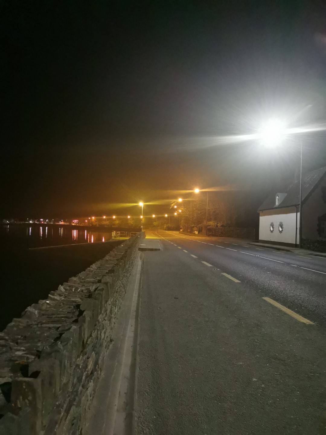
I met two vehicles in that entire section. I thought it would never end. I could see the lights of Durrus for hours. But some strongly worded self-talk kept me going ok. Particularly Yvon Chouinard’s famous “For me, when everything goes wrong, that’s when adventure starts”.
And 21 hours after I started, I arrived back to my car grinning like an idiot.
And I’m feeling good
Whilst I’m disappointed I didn’t finish the Way route, I’m actually over-the-moon about a bunch of things. I’ve never gone so far on foot. I’ve never done an activity which lasted so long, I’ve never done any sort of night-time off-road hiking/running, I’ve never carried a pack that far and I’ve never done that many miles in the hills. I was also really happy in that first 10-12 hours with how damned good I felt. I seemed to have boundless energy. I blame all those plants I’ve been eating since January 2020. Whilst the Sheep’s Head Way doesn’t have very much ascent/descent, it’s not exactly flat and I did over 7000ft of elevation.
On a different day with tougher soles (sorry Ellie and Carl) and my usual 5L Salomon pack with a few gels and bars, I think I’d be able to run much of it and finish in daylight. I won’t freak myself out by checking what FKT one of the Cork and Kerry Trail Runners mountain goats has, but I’ll be happy to claim the SKT (Slowest Known Time) in the future.
Fame
As I said afterwards on Instagram, I really do think The Sheep’s Head Way should be world famous. I’ve lived in West Cork for 18 years and have been running for 12 years and I was only vaguely aware of it as maybe some sort of less-famous “spur” of the Beara Way. It’s not just mind-bogglingly beautiful, it’s very very runnable for huge chunks of it.
Here’s the Relive.cc animation of the route:
I’m aiming to run anything that looks even vaguely like a trail in Cork whilst we’re still in county lockdown and I suspect I may be back on The Sheep’s Head again in 2021 for another go.
Next?
In the meantime where should I try next? I’ve done bits of Slí Gaeltacht Mhuscraí (Tough Soles page) near Gougane Barra / The Beara Way (Tough Soles page) near Glengarriff. Are there other really good long loops you can do in Cork that are possible without needing support/lifts? And is there anything on Mizen? I spent a lot of last week’s fun staring at it.
Final words
So whether you are a hiker, walker, road runner, trail runner or person who just likes gorgeous views, you should get your ass to The Sheep’s Head. Just leave the dogs at home, they are rightly not allowed. And make sure you leave no trace except your footprints.
Finally, once again, thank you to everyone involved in making The Sheep’s Head Way such a magical and manageable route.
comments powered by Disqus