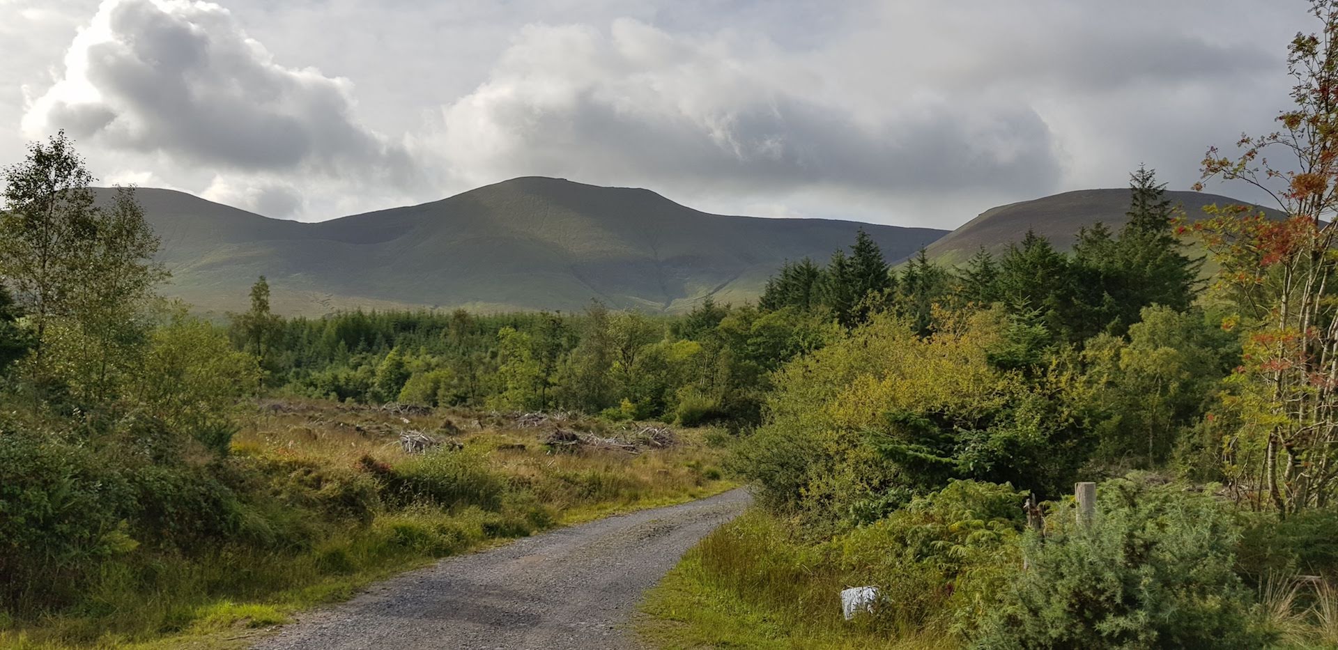
One of my favourite sights in Ireland is when I’m driving south on the M8 motorway and the Galtee Mountains appear on the horizon. At certain times of the year and day, it’s breathtaking.
The 16yo and I had a fine time out there earlier in the year with Bandon Hillwalking Club on their Open Day but I wanted to find out how much of it was runnable by someone like me. I see how fast the IMRA/MMRA guys race around via Strava but of course they are a different species to me :-)
A few weeks back I finally decided to do it.
I’m always concious of being “that guy” - the idiot who needs to be rescued off a mountain because he headed off without even a jacket or fully charged phone.
So I go completely overboard even on the easiest routes. Hydration pack, Columbia Outdry Extreme jacket (if it’s good enough for Eoin Keith at Barkley, it’s good enough for me on a Summer’s day in Cork, even if the hood cinches are rubbish), hiking poles, bivvy bag, space blanket, water, food, compass, paper map, multiple offline map apps on my phone, swiss army knife, toilet paper, power bank, whistle. You name it I have it. The only thing I’m missing is a tent, flares and breathing apparatus in case of a once-in-a-lifetime snow storm followed by avalanche. And that’s just to walk around the lake in Gougane Barra (kidding kidding. Or am I?)
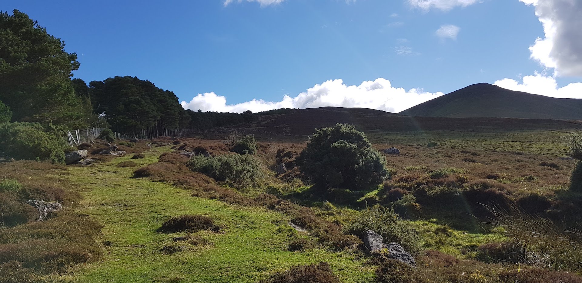
I parked at the trail head at Clydagh Bridge and checked out the Coillte signs. I chickened out and decided to just do the signposted route up to Lough Curra instead. To find my mountain legs so to speak.
One of my favourite bits is only a few yards long. It’s the Lough Curra shortcut. I thought it was going to be some sort of hill-walker in-joke but it was genuinely a shortcut.
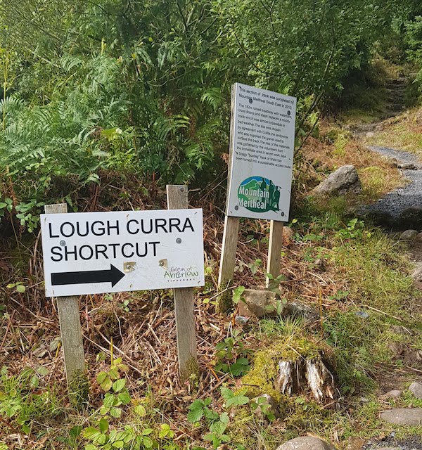
Basically the lovely Mountain Meitheal volunteers created a proper trail where people were already short-cutting. My huge disappointment is that we don’t have hundreds of miles of trails like this in Ireland. But then we’re back to my blogpost from 2016.
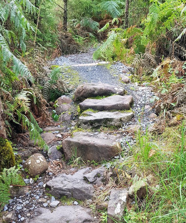
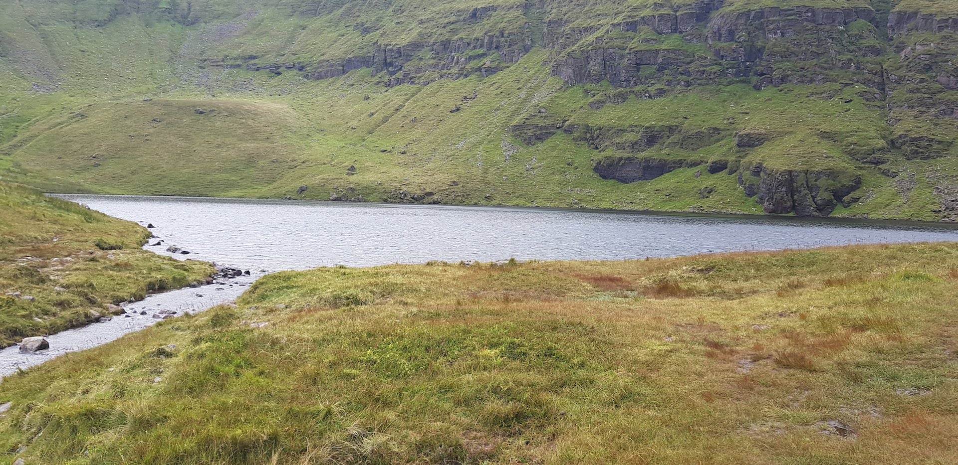
Overall it’s a fabulous route with a really great track along a ridge-line you can actually run as a normal person. It mixes forest, very steep fields, tracks and rocky bits. The lake and the surrounding cliffs are very impressive. But it wasn’t the nicest day and the cliffs freaked me out a bit. So back I trotted to the car and headed home.
Over the next two weeks, I found a few GPS traces on sites like Wikiloc of the Horseshoe Loop around several of the Galtee peaks. They were quoting 5.5+hrs for a hike. So I figured I’d be faster with some light jogging. I loaded up a clockwise loop into Viewranger on my phone and re-packed for Everest.
Back to Clydagh Bridge and up Cush I went. Zero running involved. It got steeper and steeper. Then really steep just near the summit. I started getting freaked out. What if I fell? I’d be that guy. “Stupid fat old dude dies falling down small hill - Killed by the Swiss Army Knife in his pack”.
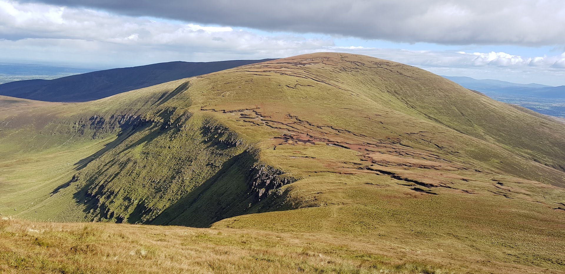
I finally edged around the summit with my poles and started the trot down. Then up Galtybeg I went. Tough but enjoyable. Windy as feck tho, despite the lovely day. And onwards to Galtymore. I was killing it even if not a lot of running was happening. The dry summer meant it wasn’t just a relentless quagmire so I was very happy.
On top of Galtymore, I took a bunch of photos in every direction. The various cliff edges totally freaked me out as much as Cush when with all the wind so I stayed very very far away.
Onwards.
I got to the top of another summit. I came to the conclusion that the default maps on Viewranger had the summits mis-labelled but it was no big deal as I just had to follow the uploaded blue line. After a slight course correction, I headed down that peak. But for some reason I seemed to be making little progress. Another 15 minutes down near another cliff edge and I realised I’d gone badly astray off the mountain and had to circle around the base to get back on track. Which I duly did. I was wrecked and a bit grumpy at this point.
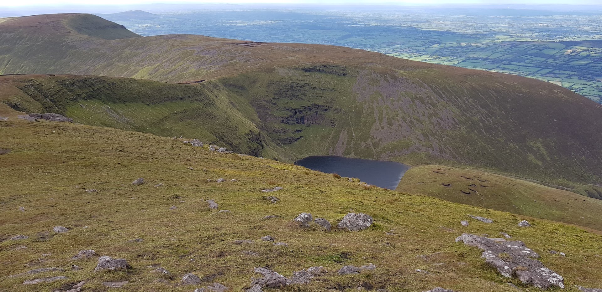
I summitted another peak. Weird. I didn’t remember there being this many of them on Wikiloc. Onwards to the cliffs above Lough Curra and I knew I was in the home straight.
I wondered why the hell someone would build a wall in the middle of nowhere at the top of a cliff on a mountain. To stop the sheep throwing themselves to their death in despair at EU agricultural policy? The youngfella explained later that evening that it was the Tipperary/Cork border! Oops. But no passport control?
The final trot down was long but great fun and the Inov-8 XCLAW 275 (sadly no longer made) were amazing all day, dealing with mud/bog, rocks and slippy grass with aplomb.
Into the forest and a final jog to the car. Bloody hell, that took 4:45hrs. So much for being a lot faster than the hikers.
Home I drove and uploaded GPS data and pics to Strava.
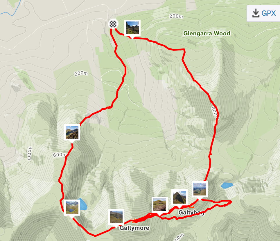
Hmm, that bit where I went astray looks weird.
Zoom in.
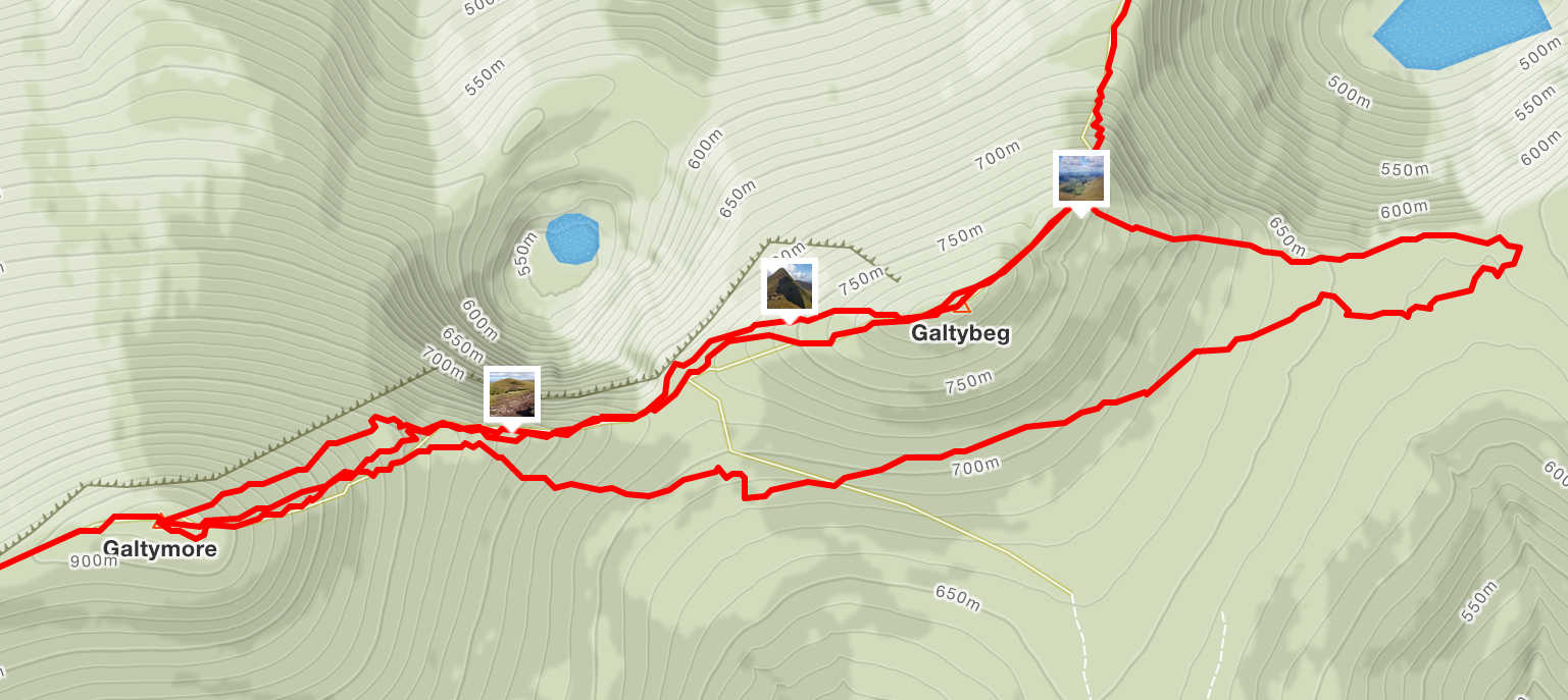
Wait a second.
Oh you are bleedin' kidding me!
This genius went:
Cush > Galtybeg > Galtymore > Back to Galtybeg!!!! > Down the wrong side of Galtybeg > Around Galtybeg > Up Galtymore > Down Galtymore > Finish.
Yep, instead of doing a full 360 when taking all my pics on Galtymore, I did a 540!
I still cannot figure out how I made such a n00b error. I was watching the trace on Viewranger most of the time - I now figure that I was so zoomed in, I didn’t realise I was following it in the wrong direction coming off Galtymore!
Ignoring my idiotic error, it’s a fabulous loop. But I don’t think I’d do it in anything but perfect weather as those cliffs are deadly and you could easily go astray in fog. Particularly if you’re me.
I now have a Moscow Thumb Compass, with L baseplate (or Thumbpass as Jeff in work brilliantly renamed it) in addition to the normal Silva and I’ll be using compasses + paper + electronics from now on. Next time I might even run a bit more.
With the weather worsening and the days much shorter, I think that’s probably me done with soloing the mountains for 2018 - like I’m some sort of Alex Honold ;-) I’m still a danger to myself on anything but clearly defined trails (and even then….). But I’m looking forward to going harder and faster at them in late Spring 2019.
comments powered by Disqus